
Trip Report: Hiking Multorpor Mountain
When: 05/11/2019
Location: Multorpor Mountain
Conditions: Clear and sunny for most of it. Patches of up to 6 inches of snow, but infrequently.
Duration: 3-ish miles out and back.
Difficulty: Medium
Kid Freindly: No
Pet Freindly: No
Usefull links: MAP
 The Full Report:
Multorpor Mountain is a great, short hike with a spectacular view at the top. It has a nice trail that, once you're on, is easy to stay on, and doesn't feel like you are on a person-made place. I went on this hike with someone who had done it before, so I mostly relied on them to guide the way, although I think I could have done it alone. It is pretty easy to find if you know what to look for.
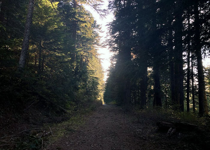
We started in Government Camp and made our way to the Ski Bowl East parking lot(I would recommend starting and parking here, and if the parking lot is closed, there is street parking around it). From there We hiked up above the conveyor lift, to the junction with Summit Trail #691, and turned left(East). At this point, we were on a well-traveled large trail that is easy to find and follow.
The Full Report:
Multorpor Mountain is a great, short hike with a spectacular view at the top. It has a nice trail that, once you're on, is easy to stay on, and doesn't feel like you are on a person-made place. I went on this hike with someone who had done it before, so I mostly relied on them to guide the way, although I think I could have done it alone. It is pretty easy to find if you know what to look for.
We started in Government Camp and made our way to the Ski Bowl East parking lot(I would recommend starting and parking here, and if the parking lot is closed, there is street parking around it). From there We hiked up above the conveyor lift, to the junction with Summit Trail #691, and turned left(East). At this point, we were on a well-traveled large trail that is easy to find and follow.
 We followed this for a little under half a mile, and right before it turns hard to the left(north), there is a power line trail that breaks off of the main trail to the right(South). At this time of year, mid-May, there was about 6 inches to a foot of snow on the power line trail, but it was mostly hard packed so we had no trouble with sinking in or keeping our footing.
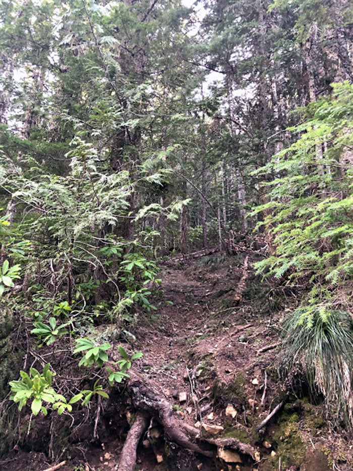
The next part of this hike is the hardest part to navigate. After following the power line trail for about a quarter mile there is a small trail that shoots off to the right(west) of the power line trail. Once we arrived at this trail, I had no problem seeing it, but you do have to make sure that you are looking for it so you don't miss it. From this point on it is just on one trail until you reach the top.
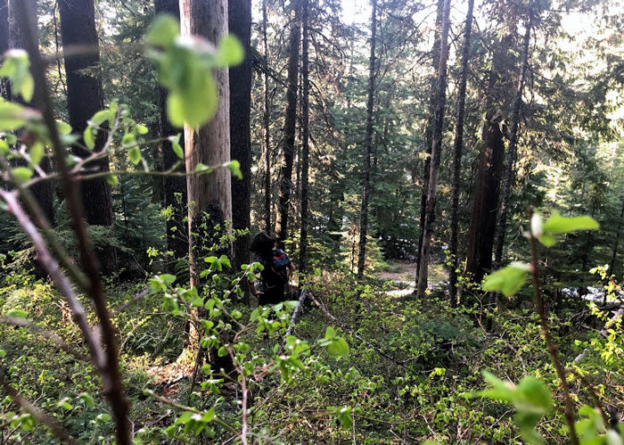
The way up had a few patches of snow but was mostly clear. The view of the forest on the way up was great, and there were a few plants starting to bloom, like skunk cabbage, which looked beautiful from the trail. There was one part of the trail which had a tree across it and two places that had small spots of erosion, but besides that the trail was clear.
We followed this for a little under half a mile, and right before it turns hard to the left(north), there is a power line trail that breaks off of the main trail to the right(South). At this time of year, mid-May, there was about 6 inches to a foot of snow on the power line trail, but it was mostly hard packed so we had no trouble with sinking in or keeping our footing.
The next part of this hike is the hardest part to navigate. After following the power line trail for about a quarter mile there is a small trail that shoots off to the right(west) of the power line trail. Once we arrived at this trail, I had no problem seeing it, but you do have to make sure that you are looking for it so you don't miss it. From this point on it is just on one trail until you reach the top.
The way up had a few patches of snow but was mostly clear. The view of the forest on the way up was great, and there were a few plants starting to bloom, like skunk cabbage, which looked beautiful from the trail. There was one part of the trail which had a tree across it and two places that had small spots of erosion, but besides that the trail was clear.
 The trail zig zags up the mountain and at each turn there is a small game trail that continues, so be careful not to accidentally follow a false trail. We took a few steps off of the trail before realizing our mistake. This whole trail is pretty steep, and I had donated a pint of blood earlier that day, so we took it slowly, and it felt like a great distance hike.
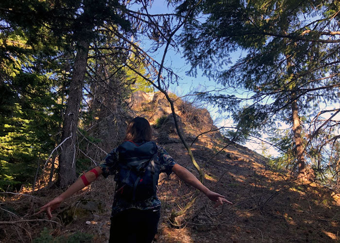
Once we reached the top there was a great view of mount hood and surrounding mountains. The top area is a large rock face that has lots of mediocre seating spots and one or two great ones. After we took a break, admired the view, hydrated, and ate some jerky, we started our descent back down. We headed downhill and eventually hit Summit Trail #691 again, which we took a left on(west) and made it back to the parking lot in no time. We then crossed highway 26 and went to dinner in Government Camp, which is conveniently close if you are hungry after this hike.
Overall, this is a great hike that I would definitely recommend it. A printout map of all the trails is very useful, and don't forget to bring water!
The trail zig zags up the mountain and at each turn there is a small game trail that continues, so be careful not to accidentally follow a false trail. We took a few steps off of the trail before realizing our mistake. This whole trail is pretty steep, and I had donated a pint of blood earlier that day, so we took it slowly, and it felt like a great distance hike.
Once we reached the top there was a great view of mount hood and surrounding mountains. The top area is a large rock face that has lots of mediocre seating spots and one or two great ones. After we took a break, admired the view, hydrated, and ate some jerky, we started our descent back down. We headed downhill and eventually hit Summit Trail #691 again, which we took a left on(west) and made it back to the parking lot in no time. We then crossed highway 26 and went to dinner in Government Camp, which is conveniently close if you are hungry after this hike.
Overall, this is a great hike that I would definitely recommend it. A printout map of all the trails is very useful, and don't forget to bring water!
The Full Report:
Multorpor Mountain is a great, short hike with a spectacular view at the top. It has a nice trail that, once you're on, is easy to stay on, and doesn't feel like you are on a person-made place. I went on this hike with someone who had done it before, so I mostly relied on them to guide the way, although I think I could have done it alone. It is pretty easy to find if you know what to look for.
We started in Government Camp and made our way to the Ski Bowl East parking lot(I would recommend starting and parking here, and if the parking lot is closed, there is street parking around it). From there We hiked up above the conveyor lift, to the junction with Summit Trail #691, and turned left(East). At this point, we were on a well-traveled large trail that is easy to find and follow.
We followed this for a little under half a mile, and right before it turns hard to the left(north), there is a power line trail that breaks off of the main trail to the right(South). At this time of year, mid-May, there was about 6 inches to a foot of snow on the power line trail, but it was mostly hard packed so we had no trouble with sinking in or keeping our footing.
The next part of this hike is the hardest part to navigate. After following the power line trail for about a quarter mile there is a small trail that shoots off to the right(west) of the power line trail. Once we arrived at this trail, I had no problem seeing it, but you do have to make sure that you are looking for it so you don't miss it. From this point on it is just on one trail until you reach the top.
The way up had a few patches of snow but was mostly clear. The view of the forest on the way up was great, and there were a few plants starting to bloom, like skunk cabbage, which looked beautiful from the trail. There was one part of the trail which had a tree across it and two places that had small spots of erosion, but besides that the trail was clear.
The trail zig zags up the mountain and at each turn there is a small game trail that continues, so be careful not to accidentally follow a false trail. We took a few steps off of the trail before realizing our mistake. This whole trail is pretty steep, and I had donated a pint of blood earlier that day, so we took it slowly, and it felt like a great distance hike.
Once we reached the top there was a great view of mount hood and surrounding mountains. The top area is a large rock face that has lots of mediocre seating spots and one or two great ones. After we took a break, admired the view, hydrated, and ate some jerky, we started our descent back down. We headed downhill and eventually hit Summit Trail #691 again, which we took a left on(west) and made it back to the parking lot in no time. We then crossed highway 26 and went to dinner in Government Camp, which is conveniently close if you are hungry after this hike.
Overall, this is a great hike that I would definitely recommend it. A printout map of all the trails is very useful, and don't forget to bring water!