
Trip Report: Backpacking The Northern Loop Trail, Mt. Rainier National Park
When: 9/28/2018
Location: The Northern Loop Trail, Mt. Rainier National Park
Conditions: Mixed sun and clouds with night time rain, 50's - 60's
Duration: 3 Days, 2 Nights
Difficulty: Difficult
Kid Friendly: No
Pet Friendly: No
Usefull links: www.nps.gov | www.alltrails.com
 The Full Report:
The Northern Loop Trail is a moderate to lightly trafficked trail traveling through the heart of Northern Rainier National Park. Arguably the most remote and wilderness area of the entire park. The loop consists of multiple trails linked together, with the bulk of the miles being on the Northern Loop Trail and famous Wonderland Trail.
Starting at the busy Sunrise parking area start along the Sourdough Ridge trail, traveling west, passing a two, then four-way split in trails will lead you to a third split. Here you can go right following the Northern Loop Trail (Counterclockwise) or stay straight following the Wonderland Trail (Clockwise). I decided to go counter-clockwise, thus leaving the busy Sourdough Ridge/Wonderland Trail and onto the Northern Loop Trail.
The Full Report:
The Northern Loop Trail is a moderate to lightly trafficked trail traveling through the heart of Northern Rainier National Park. Arguably the most remote and wilderness area of the entire park. The loop consists of multiple trails linked together, with the bulk of the miles being on the Northern Loop Trail and famous Wonderland Trail.
Starting at the busy Sunrise parking area start along the Sourdough Ridge trail, traveling west, passing a two, then four-way split in trails will lead you to a third split. Here you can go right following the Northern Loop Trail (Counterclockwise) or stay straight following the Wonderland Trail (Clockwise). I decided to go counter-clockwise, thus leaving the busy Sourdough Ridge/Wonderland Trail and onto the Northern Loop Trail.
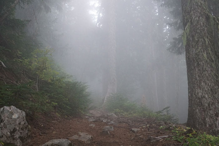
 Descending down from Sourdough Ridge, you will travel up and down through the forest, past the small Berkeley Park camp, and eventually entering Grand Park- a flat and wide grassy area with patches of trees scattered throughout. After passing the turnoff from Lake Eleanor side trail, the trail heads back into the Forest and descends down past Fire Creek Camp and then further down to the West Fork of the White River. Here you will cross a wide river basin and start a 2600-foot climb first past James Camp/James Lake, and then further up to Windy Gap.
From Windy Gap, the trail meanders through some of the most remote and wildlife-filled areas of the park, with sweeping views of mountain valleys and colorful cliffs in every direction until you reach the beautiful Yellowstone Cliff’s campground. From here the trail then begins a long steep downhill stretch to the Carbon River.
Descending down from Sourdough Ridge, you will travel up and down through the forest, past the small Berkeley Park camp, and eventually entering Grand Park- a flat and wide grassy area with patches of trees scattered throughout. After passing the turnoff from Lake Eleanor side trail, the trail heads back into the Forest and descends down past Fire Creek Camp and then further down to the West Fork of the White River. Here you will cross a wide river basin and start a 2600-foot climb first past James Camp/James Lake, and then further up to Windy Gap.
From Windy Gap, the trail meanders through some of the most remote and wildlife-filled areas of the park, with sweeping views of mountain valleys and colorful cliffs in every direction until you reach the beautiful Yellowstone Cliff’s campground. From here the trail then begins a long steep downhill stretch to the Carbon River.
 From the Carbon River Crossing, find the Wonderland Trail and follow it towards the Upper Crossing/Suspension Bridge. (You can also choose to follow the river bed south to the same area or take the alternate trail before the Carbon River crossing, and link up with the Wonderland Trail at the bridge itself. The last option may be necessary for the early season when water is high)
From here, the trail starts another long and steep uphill section to Mystic Lake and Mystic Lake Campground. The last 7 miles of trail will take you another 1000 feet down, then 2000 feet up through forests and along ridgelines marking the last big elevation changes of the trail, eventually meeting up with the Fork of the Wonderland and Northern Loop trail. From here follow the Sourdough Ridge back to the Sunrise Parking area and the start of your journey!
From the Carbon River Crossing, find the Wonderland Trail and follow it towards the Upper Crossing/Suspension Bridge. (You can also choose to follow the river bed south to the same area or take the alternate trail before the Carbon River crossing, and link up with the Wonderland Trail at the bridge itself. The last option may be necessary for the early season when water is high)
From here, the trail starts another long and steep uphill section to Mystic Lake and Mystic Lake Campground. The last 7 miles of trail will take you another 1000 feet down, then 2000 feet up through forests and along ridgelines marking the last big elevation changes of the trail, eventually meeting up with the Fork of the Wonderland and Northern Loop trail. From here follow the Sourdough Ridge back to the Sunrise Parking area and the start of your journey!
 Other Considerations:
River Crossings
Depending on the seasons many of the river crossings in the park can be hazardous, with the log bridges completely washed out and underwater (Especially in spring/early summer). Do research on these areas, find alternative routes, and plan for the time slow up accordingly. These will be the most dangerous parts of any Cascade Volcano loop hike.
Campgrounds
Most Campgrounds along the loop are relatively small with 2-4 spots. Exceptions being the Yellowstone Cliffs and Mystic Lake Campgrounds.
All established campgrounds will have bear poles for storing food at night, meaning a bear canister is not required as long as you plan on sleeping at designated campgrounds (highly encouraged).
Permits - Required for any camping in the park.
The Wonderland trail is a wildly popular loop hike circumnavigating the base of Mt. Rainier. The 93-mile trail requires hard to get permits to complete, and the campgrounds along it are often booked fully in peak summer months. Plan accordingly and try and reserve spots for any campgrounds along it.
Side Hikes
The Natural Bridge side hike just before Windy Gap is a 1.8 mile(total) out and back featuring a natural bridge, views up towards the Northern Cascades and an awesome ridge walk along the way.
Another worth checking out is Lake Eleanor. The 3.5-mile (each way) side trail at the end of the Grand Park grassy ridge is a very remote lake with a campground located at the far north end of the National Park. It can provide tons of solitude as well as beautiful setting for those looking to really take their time along the route.
In recap, the trail can offer a ton of solitude along the remote Northern portions and finishes up on some of the most beautiful trail in the country along the Wonderland Trail. I would rate the walking as difficult, with constant 1000+ foot climbs and descents. It’s a highly challenging, high reward trail for those who have backpacked before and know what 10000+ feet of elevation change in 30ish miles or so really means.
Other Considerations:
River Crossings
Depending on the seasons many of the river crossings in the park can be hazardous, with the log bridges completely washed out and underwater (Especially in spring/early summer). Do research on these areas, find alternative routes, and plan for the time slow up accordingly. These will be the most dangerous parts of any Cascade Volcano loop hike.
Campgrounds
Most Campgrounds along the loop are relatively small with 2-4 spots. Exceptions being the Yellowstone Cliffs and Mystic Lake Campgrounds.
All established campgrounds will have bear poles for storing food at night, meaning a bear canister is not required as long as you plan on sleeping at designated campgrounds (highly encouraged).
Permits - Required for any camping in the park.
The Wonderland trail is a wildly popular loop hike circumnavigating the base of Mt. Rainier. The 93-mile trail requires hard to get permits to complete, and the campgrounds along it are often booked fully in peak summer months. Plan accordingly and try and reserve spots for any campgrounds along it.
Side Hikes
The Natural Bridge side hike just before Windy Gap is a 1.8 mile(total) out and back featuring a natural bridge, views up towards the Northern Cascades and an awesome ridge walk along the way.
Another worth checking out is Lake Eleanor. The 3.5-mile (each way) side trail at the end of the Grand Park grassy ridge is a very remote lake with a campground located at the far north end of the National Park. It can provide tons of solitude as well as beautiful setting for those looking to really take their time along the route.
In recap, the trail can offer a ton of solitude along the remote Northern portions and finishes up on some of the most beautiful trail in the country along the Wonderland Trail. I would rate the walking as difficult, with constant 1000+ foot climbs and descents. It’s a highly challenging, high reward trail for those who have backpacked before and know what 10000+ feet of elevation change in 30ish miles or so really means.


The Full Report:
The Northern Loop Trail is a moderate to lightly trafficked trail traveling through the heart of Northern Rainier National Park. Arguably the most remote and wilderness area of the entire park. The loop consists of multiple trails linked together, with the bulk of the miles being on the Northern Loop Trail and famous Wonderland Trail.
Starting at the busy Sunrise parking area start along the Sourdough Ridge trail, traveling west, passing a two, then four-way split in trails will lead you to a third split. Here you can go right following the Northern Loop Trail (Counterclockwise) or stay straight following the Wonderland Trail (Clockwise). I decided to go counter-clockwise, thus leaving the busy Sourdough Ridge/Wonderland Trail and onto the Northern Loop Trail.
Descending down from Sourdough Ridge, you will travel up and down through the forest, past the small Berkeley Park camp, and eventually entering Grand Park- a flat and wide grassy area with patches of trees scattered throughout. After passing the turnoff from Lake Eleanor side trail, the trail heads back into the Forest and descends down past Fire Creek Camp and then further down to the West Fork of the White River. Here you will cross a wide river basin and start a 2600-foot climb first past James Camp/James Lake, and then further up to Windy Gap.
From Windy Gap, the trail meanders through some of the most remote and wildlife-filled areas of the park, with sweeping views of mountain valleys and colorful cliffs in every direction until you reach the beautiful Yellowstone Cliff’s campground. From here the trail then begins a long steep downhill stretch to the Carbon River.
From the Carbon River Crossing, find the Wonderland Trail and follow it towards the Upper Crossing/Suspension Bridge. (You can also choose to follow the river bed south to the same area or take the alternate trail before the Carbon River crossing, and link up with the Wonderland Trail at the bridge itself. The last option may be necessary for the early season when water is high)
From here, the trail starts another long and steep uphill section to Mystic Lake and Mystic Lake Campground. The last 7 miles of trail will take you another 1000 feet down, then 2000 feet up through forests and along ridgelines marking the last big elevation changes of the trail, eventually meeting up with the Fork of the Wonderland and Northern Loop trail. From here follow the Sourdough Ridge back to the Sunrise Parking area and the start of your journey!
Other Considerations:
River Crossings
Depending on the seasons many of the river crossings in the park can be hazardous, with the log bridges completely washed out and underwater (Especially in spring/early summer). Do research on these areas, find alternative routes, and plan for the time slow up accordingly. These will be the most dangerous parts of any Cascade Volcano loop hike.
Campgrounds
Most Campgrounds along the loop are relatively small with 2-4 spots. Exceptions being the Yellowstone Cliffs and Mystic Lake Campgrounds.
All established campgrounds will have bear poles for storing food at night, meaning a bear canister is not required as long as you plan on sleeping at designated campgrounds (highly encouraged).
Permits - Required for any camping in the park.
The Wonderland trail is a wildly popular loop hike circumnavigating the base of Mt. Rainier. The 93-mile trail requires hard to get permits to complete, and the campgrounds along it are often booked fully in peak summer months. Plan accordingly and try and reserve spots for any campgrounds along it.
Side Hikes
The Natural Bridge side hike just before Windy Gap is a 1.8 mile(total) out and back featuring a natural bridge, views up towards the Northern Cascades and an awesome ridge walk along the way.
Another worth checking out is Lake Eleanor. The 3.5-mile (each way) side trail at the end of the Grand Park grassy ridge is a very remote lake with a campground located at the far north end of the National Park. It can provide tons of solitude as well as beautiful setting for those looking to really take their time along the route.
In recap, the trail can offer a ton of solitude along the remote Northern portions and finishes up on some of the most beautiful trail in the country along the Wonderland Trail. I would rate the walking as difficult, with constant 1000+ foot climbs and descents. It’s a highly challenging, high reward trail for those who have backpacked before and know what 10000+ feet of elevation change in 30ish miles or so really means.