
Trip Report: Bonneville Trailhead to Table Mountain Hike
When: 11/10/2017
Location: Bonneville Trailhead to Table Mountain
Conditions: Strong winds and rain. Poor visibility. Definitely bundle up and layer appropriately!
Duration: 7 miles
Difficulty: Moderate
Kid Friendly: No
Pet Friendly: Yes
Useful links: www.oregonhikers.org
 The Full Report:
My exploration of the Washington side of the Columbia Gorge continued as I looked to hike a classic, Table Mountain. That was at least my intention when my friend Zach and I set out from Portland this morning. What would actually happen is that we would hike 7 miles of the trail and turn back because of inclement weather conditions.
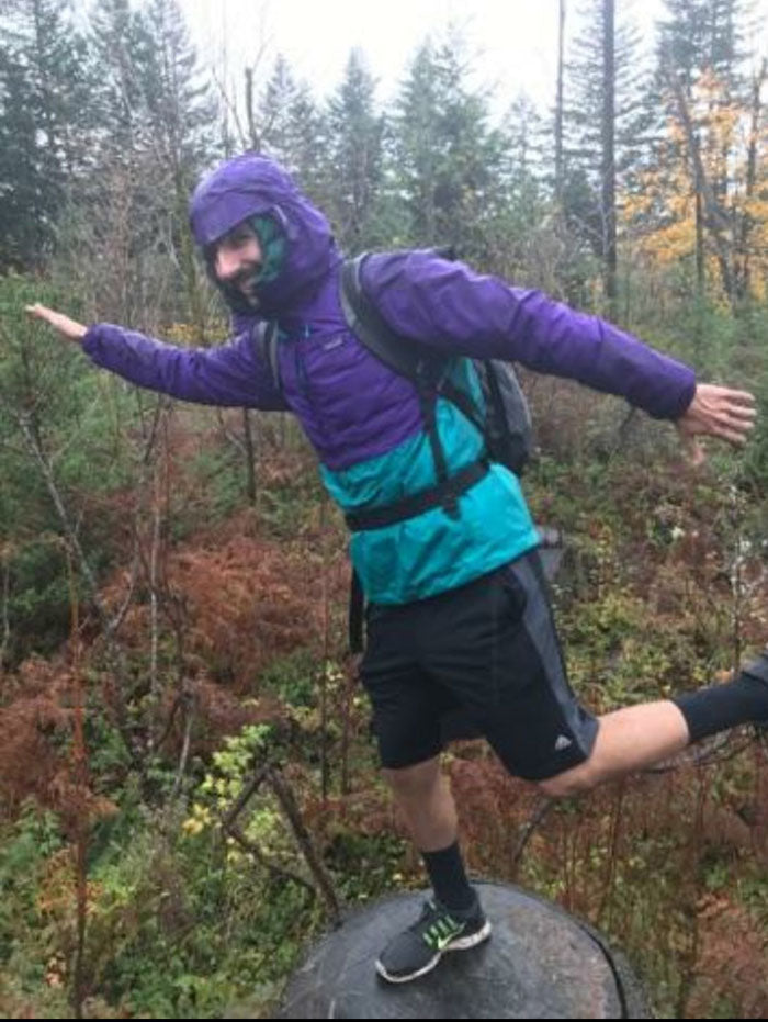
As we learned, winter hiking is definitely a sport for the most courageous, and more importantly, the most prepared among us. I had layered with a shirt, fleece, down jacket, and rain jacket, so I was fine. But Zach's water-resistant jacket did not do the job, and he was soaked by the time we decided to head back to the trailhead. That being said, we still enjoyed ourselves and despite the rain, took in some beautiful views.
The Full Report:
My exploration of the Washington side of the Columbia Gorge continued as I looked to hike a classic, Table Mountain. That was at least my intention when my friend Zach and I set out from Portland this morning. What would actually happen is that we would hike 7 miles of the trail and turn back because of inclement weather conditions.
As we learned, winter hiking is definitely a sport for the most courageous, and more importantly, the most prepared among us. I had layered with a shirt, fleece, down jacket, and rain jacket, so I was fine. But Zach's water-resistant jacket did not do the job, and he was soaked by the time we decided to head back to the trailhead. That being said, we still enjoyed ourselves and despite the rain, took in some beautiful views.
 When we arrived at the trailhead, we were greeted by a light sprinkle of rain and empty parking lot (I love when this happens!). It's important to note that you need a Northwest Forest pass to park in the lot. There were passes available at the trailhead shelter with the typical envelope set-up and honors system for payment ($5 at this location for the day). Similarly, there is a toll for the Bridge of the Gods which brings you from the Oregon to Washington side. This $2 both ways ($4 total, cash only).
The logistics put behind us, we hiked onward from the paved lot to the start of the trail. The beginning of the trail is marked by a 3-foot tall wooden post. The post itself is not marked but is a more welcoming looking entrance than the other gated off logging roads. From this point on, the trail began with a slight incline and within a few minutes, we were enveloped by the Washingtonian wilderness.
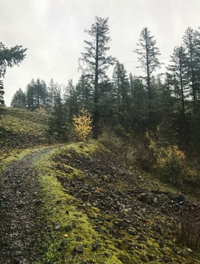
The trail is covered in ferns, lupine, and smooth-leafed douglasia. Although the plants were not in bloom this time of year, the trail was painted with vibrant reds and yellows. Be cautious though when walking on the trail. There was poison ivy in some sections before the first large clear-cut area. Overall, the gain in elevation throughout the small section of the trail (first 3.5 miles and back) we hiked wasn't drastic and the low-lying valleys visible from higher points on the trail were gorgeous.
When we arrived at the trailhead, we were greeted by a light sprinkle of rain and empty parking lot (I love when this happens!). It's important to note that you need a Northwest Forest pass to park in the lot. There were passes available at the trailhead shelter with the typical envelope set-up and honors system for payment ($5 at this location for the day). Similarly, there is a toll for the Bridge of the Gods which brings you from the Oregon to Washington side. This $2 both ways ($4 total, cash only).
The logistics put behind us, we hiked onward from the paved lot to the start of the trail. The beginning of the trail is marked by a 3-foot tall wooden post. The post itself is not marked but is a more welcoming looking entrance than the other gated off logging roads. From this point on, the trail began with a slight incline and within a few minutes, we were enveloped by the Washingtonian wilderness.
The trail is covered in ferns, lupine, and smooth-leafed douglasia. Although the plants were not in bloom this time of year, the trail was painted with vibrant reds and yellows. Be cautious though when walking on the trail. There was poison ivy in some sections before the first large clear-cut area. Overall, the gain in elevation throughout the small section of the trail (first 3.5 miles and back) we hiked wasn't drastic and the low-lying valleys visible from higher points on the trail were gorgeous.
 Interestingly enough, because this trail is next to a logging road, we noticed that many meadows existed along the trail with new growth trees that had probably been replanted after clear cuts within the last decade. About a half mile in, there is a marker for Table Mountain as well as a PCT link-up trail that is a continuation of the PCT from the south. We turned left to head towards Table Mountain at this junction.
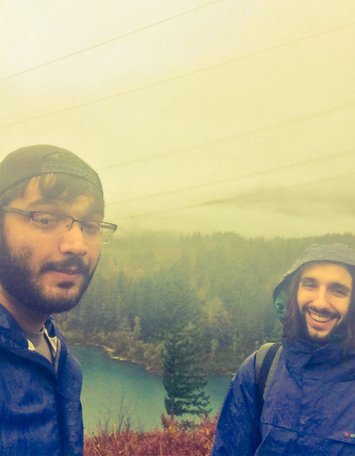
Before we encountered the first massive clear-cut section after 2 miles of hiking, much of our hiking was through dense, packed forest with verdant walls of ferns within valleys near the trail. The rain was picking up at this point, but we were still smiling and hitting our hikers high. After we exited the denser forest, the trail opened to a large clear-cut section where we stopped to eat lunch and refuel. Visibility wasn't amazing because of fog, but we could see much of the landscape below after scaling the top of the clear-cut hill.
Interestingly enough, because this trail is next to a logging road, we noticed that many meadows existed along the trail with new growth trees that had probably been replanted after clear cuts within the last decade. About a half mile in, there is a marker for Table Mountain as well as a PCT link-up trail that is a continuation of the PCT from the south. We turned left to head towards Table Mountain at this junction.
Before we encountered the first massive clear-cut section after 2 miles of hiking, much of our hiking was through dense, packed forest with verdant walls of ferns within valleys near the trail. The rain was picking up at this point, but we were still smiling and hitting our hikers high. After we exited the denser forest, the trail opened to a large clear-cut section where we stopped to eat lunch and refuel. Visibility wasn't amazing because of fog, but we could see much of the landscape below after scaling the top of the clear-cut hill.
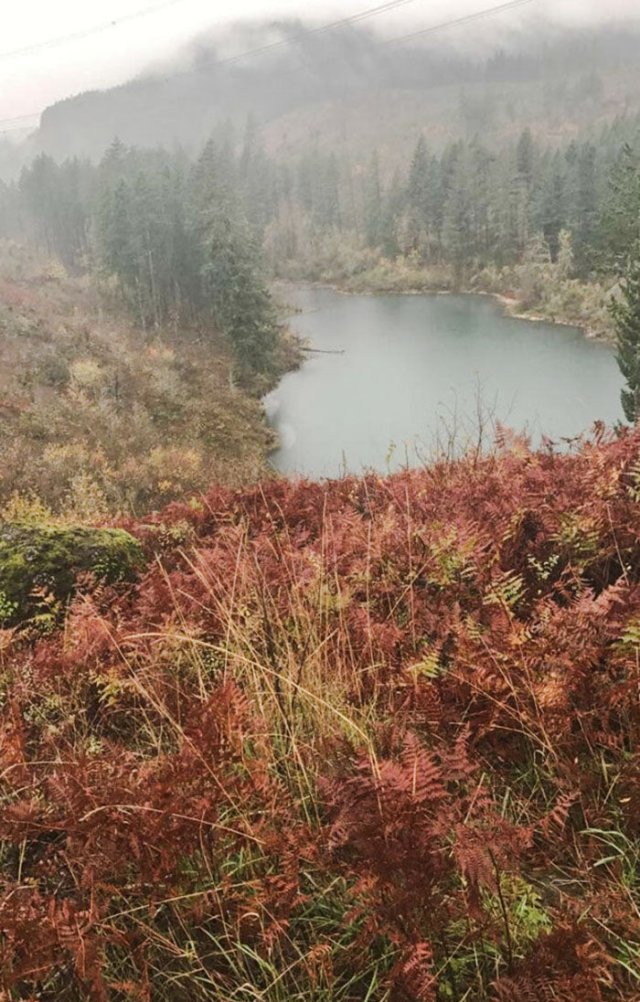
 After a quick 10-minute break, we crossed a logging road to continue to the next section of the trail and the rain was dumping. Lucky for us, we spotted a lake a half mile later to enjoy and grab some cover. The small reservoir was crystal clear (probably oligotrophic) but had a blue-emerald like quality in color. There was a campsite entrance trail to access the shore and we noticed a couple of backpackers taking shelter from the rain in a cozy bivy sack. The rain had let up a bit, but after skipping some rocks and enjoying the peacefulness of the lake, we decided that for Zach's comfort and safety, it was probably a good idea to head back before he got too cold.
Much of the trail on the way back was downhill and muddy, so we were careful with foot placement and paced ourselves. Upon reaching the parking lot, we stripped off our wet jackets and threw our socks on the heater vents in the car. We cranked the heat up to toasty and played some Arlo Guthrie to drive back through the twisting country roads.
After a quick 10-minute break, we crossed a logging road to continue to the next section of the trail and the rain was dumping. Lucky for us, we spotted a lake a half mile later to enjoy and grab some cover. The small reservoir was crystal clear (probably oligotrophic) but had a blue-emerald like quality in color. There was a campsite entrance trail to access the shore and we noticed a couple of backpackers taking shelter from the rain in a cozy bivy sack. The rain had let up a bit, but after skipping some rocks and enjoying the peacefulness of the lake, we decided that for Zach's comfort and safety, it was probably a good idea to head back before he got too cold.
Much of the trail on the way back was downhill and muddy, so we were careful with foot placement and paced ourselves. Upon reaching the parking lot, we stripped off our wet jackets and threw our socks on the heater vents in the car. We cranked the heat up to toasty and played some Arlo Guthrie to drive back through the twisting country roads.
The Full Report:
My exploration of the Washington side of the Columbia Gorge continued as I looked to hike a classic, Table Mountain. That was at least my intention when my friend Zach and I set out from Portland this morning. What would actually happen is that we would hike 7 miles of the trail and turn back because of inclement weather conditions.
As we learned, winter hiking is definitely a sport for the most courageous, and more importantly, the most prepared among us. I had layered with a shirt, fleece, down jacket, and rain jacket, so I was fine. But Zach's water-resistant jacket did not do the job, and he was soaked by the time we decided to head back to the trailhead. That being said, we still enjoyed ourselves and despite the rain, took in some beautiful views.
When we arrived at the trailhead, we were greeted by a light sprinkle of rain and empty parking lot (I love when this happens!). It's important to note that you need a Northwest Forest pass to park in the lot. There were passes available at the trailhead shelter with the typical envelope set-up and honors system for payment ($5 at this location for the day). Similarly, there is a toll for the Bridge of the Gods which brings you from the Oregon to Washington side. This $2 both ways ($4 total, cash only).
The logistics put behind us, we hiked onward from the paved lot to the start of the trail. The beginning of the trail is marked by a 3-foot tall wooden post. The post itself is not marked but is a more welcoming looking entrance than the other gated off logging roads. From this point on, the trail began with a slight incline and within a few minutes, we were enveloped by the Washingtonian wilderness.
The trail is covered in ferns, lupine, and smooth-leafed douglasia. Although the plants were not in bloom this time of year, the trail was painted with vibrant reds and yellows. Be cautious though when walking on the trail. There was poison ivy in some sections before the first large clear-cut area. Overall, the gain in elevation throughout the small section of the trail (first 3.5 miles and back) we hiked wasn't drastic and the low-lying valleys visible from higher points on the trail were gorgeous.
Interestingly enough, because this trail is next to a logging road, we noticed that many meadows existed along the trail with new growth trees that had probably been replanted after clear cuts within the last decade. About a half mile in, there is a marker for Table Mountain as well as a PCT link-up trail that is a continuation of the PCT from the south. We turned left to head towards Table Mountain at this junction.
Before we encountered the first massive clear-cut section after 2 miles of hiking, much of our hiking was through dense, packed forest with verdant walls of ferns within valleys near the trail. The rain was picking up at this point, but we were still smiling and hitting our hikers high. After we exited the denser forest, the trail opened to a large clear-cut section where we stopped to eat lunch and refuel. Visibility wasn't amazing because of fog, but we could see much of the landscape below after scaling the top of the clear-cut hill.
After a quick 10-minute break, we crossed a logging road to continue to the next section of the trail and the rain was dumping. Lucky for us, we spotted a lake a half mile later to enjoy and grab some cover. The small reservoir was crystal clear (probably oligotrophic) but had a blue-emerald like quality in color. There was a campsite entrance trail to access the shore and we noticed a couple of backpackers taking shelter from the rain in a cozy bivy sack. The rain had let up a bit, but after skipping some rocks and enjoying the peacefulness of the lake, we decided that for Zach's comfort and safety, it was probably a good idea to head back before he got too cold.
Much of the trail on the way back was downhill and muddy, so we were careful with foot placement and paced ourselves. Upon reaching the parking lot, we stripped off our wet jackets and threw our socks on the heater vents in the car. We cranked the heat up to toasty and played some Arlo Guthrie to drive back through the twisting country roads.